How to enable satellite view in Google Maps
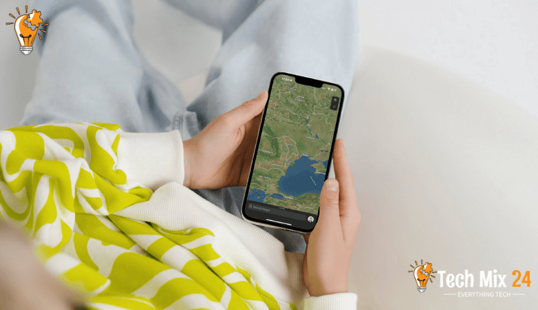
How to enable satellite view in Google Maps
Table of Contents
When navigating and exploring the digital world, there can be no more powerful and popular tool than Google Maps. This leading mapping service from Google offers a variety of options and features that help users find places and plan their routes easily. The “Satellite View” feature allows users to access live satellite images of different locations worldwide. A satellite view can be invaluable for searching for detailed information about locations, planning trips, and exploring areas better.
How to enable satellite view in Google Maps
In this article, we will review Enable satellite view on Google Maps in detail. We will provide easy steps to activate this mode and enjoy amazing views of locations via Satellite. You will learn how to start this mode on your mobile phone or computer and explore the world uniquely. If you’re looking for a way to use Google Maps better and get the most out of its features, look no further because we’ll guide you step by step on this journey into the satellite world of Google Maps.
Watch also: Getting directions on Google Maps.
Why do we use satellite view in Google Maps?
Satellite views can be used to help with positioning and orientation on maps. When users see realistic images of the areas they are searching, they can better recognize landmarks and landmarks and choose the best routes. Satellite views can help users plan their trips and explore new areas. Users can view in advance the places they want to visit and explore their surroundings.
Satellite views are used to understand the environment and geography of specific areas. Users can observe terrain, geographic patterns, and changes in the background using these images, enabling them to study places better.
Google Maps for Android
Google Maps for iPhone
View Google Maps in satellite mode
In the present era of information technology, Google Maps has become a crucial tool for exploring the digital world. Its easy-to-use interface enables users to navigate and discover new places with ease. This paragraph will explore how users can enjoy a distinctive experience by switching to satellite mode on Google Maps. We will examine the process of enabling satellite mode and how it can help users access fine details of locations and landscapes, thereby providing an engaging and realistic view.
First, after opening Google Maps on Android, you will tap on your profile marker. As shown below in the picture.
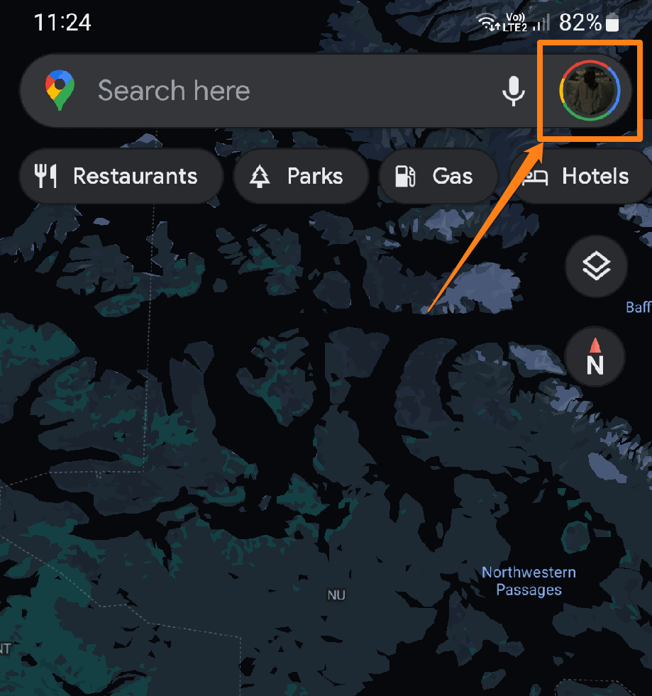
After clicking on the profile icon at the top.
A menu will open for you, and you will go to the word Settings. To open the Google Maps application settings.
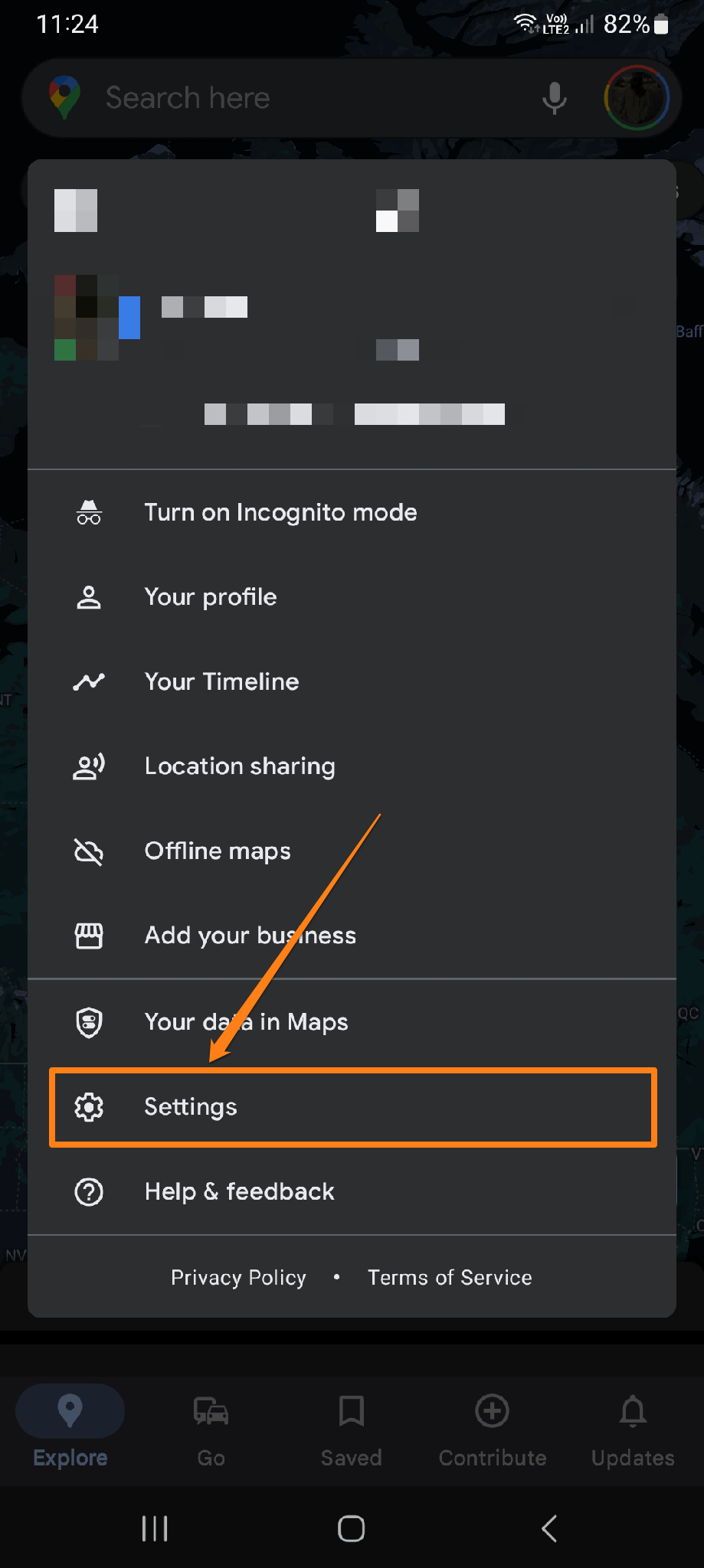
After that, you will scroll to the bottom.
You will see the option “Start maps in satellite view.” You will activate the switch to activate it.
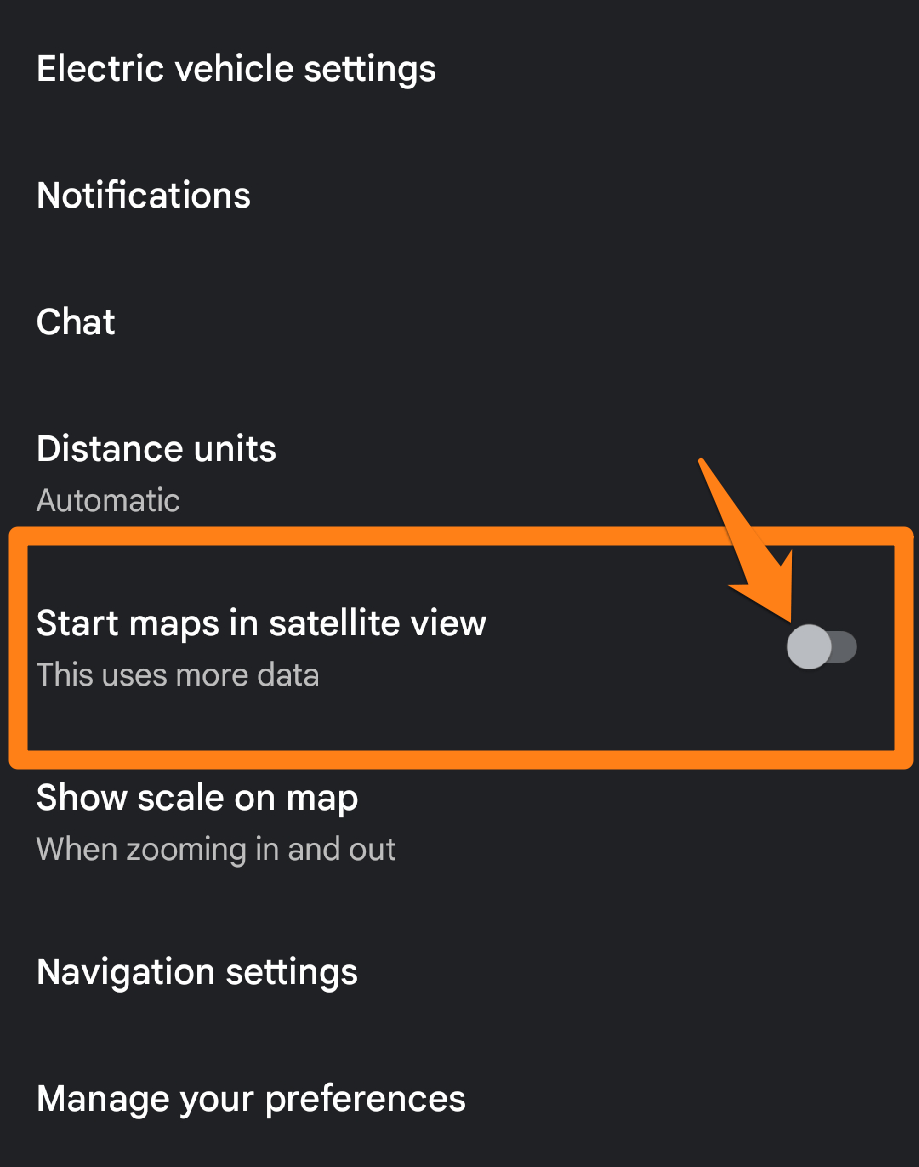
After activating the Start maps in the satellite view button, you will return to the home page. You will notice that Google Maps satellite imagery has been activated.
Google Maps’ satellite mode provides users an exceptional opportunity to explore destinations worldwide virtually. The feature grants access to a natural and realistic view of cities, landmarks, and nature, enhancing the digital map experience. Whether users want to plan their travels or explore unknown places, Google Maps’ satellite mode offers an excellent platform to embark on an exciting virtual journey and discover the beauty and details of different locations.
Satellite view on Google Maps on iPhone
Among the various apps available on iPhone devices, Google Maps stands out as one of the most advanced and widely used. This paragraph will explore how users can enhance their mapping experience by utilizing the satellite mode feature on Google Maps for iPhone. We will share insights on activating this unique mode that provides an aerial view of locations in remarkable detail and how users can leverage it to explore places of interest virtually.
Tap the Layers button in the top right corner on iPhone and iPad.
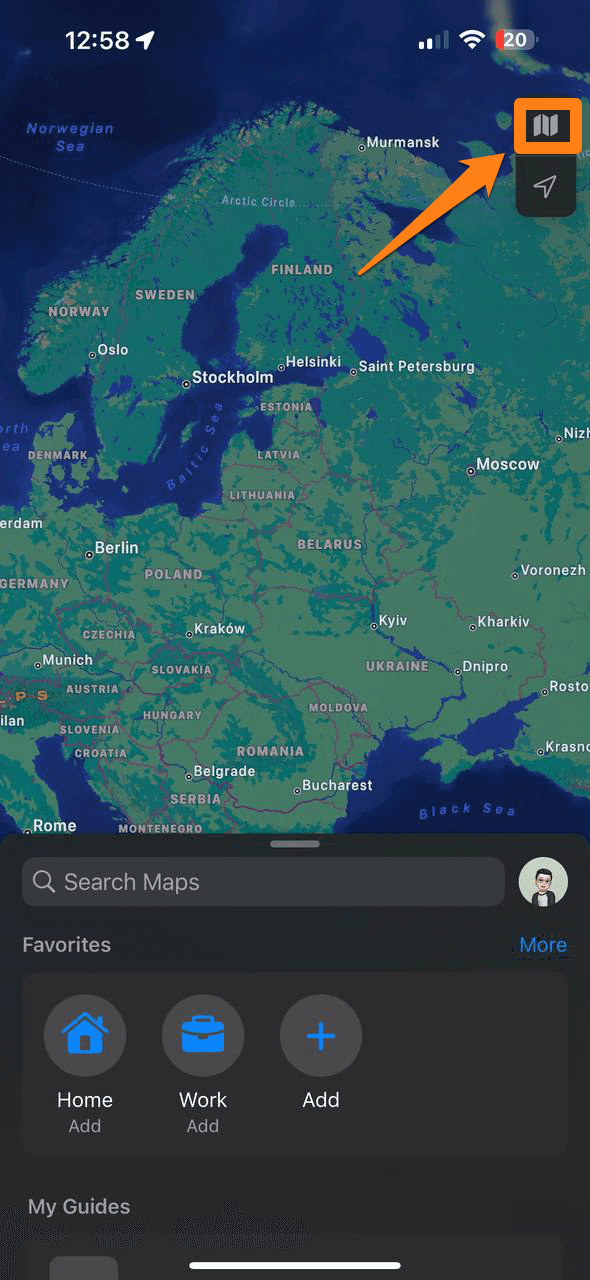
You will click on the Satellite in the map type section of the list.
To activate the Satellite view.
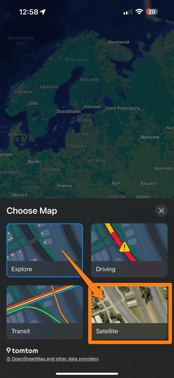
Thus, you can easily activate your iPhone’s satellite views on Google Maps.
Now, you can enjoy satellite view on Google Maps during your travels or explore live areas.
The Google Maps app on iPhone offers an exceptional opportunity to explore the world in a new and exciting way through its satellite functionality. Users can enjoy a comprehensive and realistic view of sites and landmarks, adding depth and detail to the digital navigation experience. Utilizing Satellite Mode can enrich one’s technological journey and make exploring the world via phone exciting and engaging.
Conclusion
At the end of this article, we invite you to explore the world from a new and fantastic perspective by activating Google Satellite Maps. Discover natural beauties, cities, and tourist attractions uniquely and excitingly. Open Google Maps and admire the world from outer space at your fingertips. Don’t miss the opportunity to enjoy a fun experience and learn more about the places that interest you by viewing satellite maps in Google Maps.


